I thought some of you might find it useful too, so here's a step by step - I'm obviously not using my house as a starting point because I'm not about to publish my full address on the internet, so I've just picked one at random from somewhere I know quite well.
1) First, go to maps.google.co.uk (or maps.google.com if you're not UK based ) and find the link towards the top left of the page that says "get directions" - click on it.
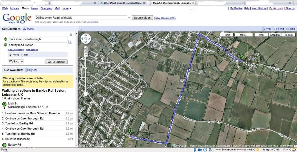
2) Enter your chosen starting point (e.g. your own address) in the A box and where it says "by car" in the drop-down underneath the boxes, click on the arrow and choose "walking". Now click on the button that says "Get Directions" and you should see a map with a green A pointing at your start point. You can drag the arrow if it's not quite in the right place.
3) In the B box, add the destination that is the apex of your walk. So, for this example, I'm using Barkby Road, Syston. Click on Get Directions again, and you should now have a blue route which takes you from point A to point B, like the example below. You can drag point B using the mouse if you want to.
4) Now click on the link where it says "Add Destination" and another box will appear. Type in the same location as your starting point, and click on "Get Directions". You will now have point C on your map, in the same place as point A. Depending on where you put point B, you may find that B to C is the same as A to B. If so, click on the blue line and drag it to where you want it, it will move under the mouse pointer and will "snap" to the nearest road (or in some places, pedestrian footpath).
Ta-Da!! You should now have your route mapped out, and on the left hand side you should see that it gives you an overall distance.
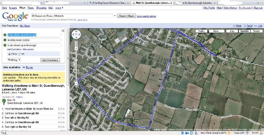
If, like me, you didn't get the starting point quite right, you can move it, and if you want the route to deviate slightly from the one Google suggests, you can just keep dragging the blue line around until you're happy - took me a while to get the hang of it but in terms of either designing a walk for the future or more usually figuring out how far we've just bimbled, I haven't found anything better yet.
Hopefully at some point they'll add in bridleways etc
Hope you find it as useful as I have!!
